A Faster Way to Design Better Streets
Road cross section software helps transportation engineers, urban planners and design teams turn street concepts into clear, accurate visual sections. Instead of rebuilding drawings manually whenever a lane, sidewalk, bike path or planting strip changes, teams can work with parameters, review alternatives and produce presentation-ready outputs faster.
For modern corridor and streetscape projects, the cross section is more than a technical drawing. It is a practical tool for balancing movement, safety, accessibility, public space and infrastructure within a limited right-of-way.
What Is Road Cross Section Software?
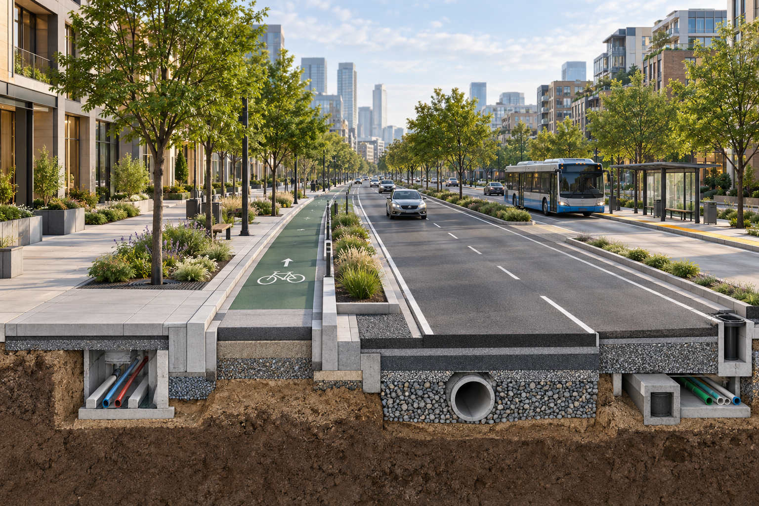
Road cross section software is a specialized planning and design tool used to create a vertical or cutaway view of a street. It shows how the available width is allocated between elements such as:
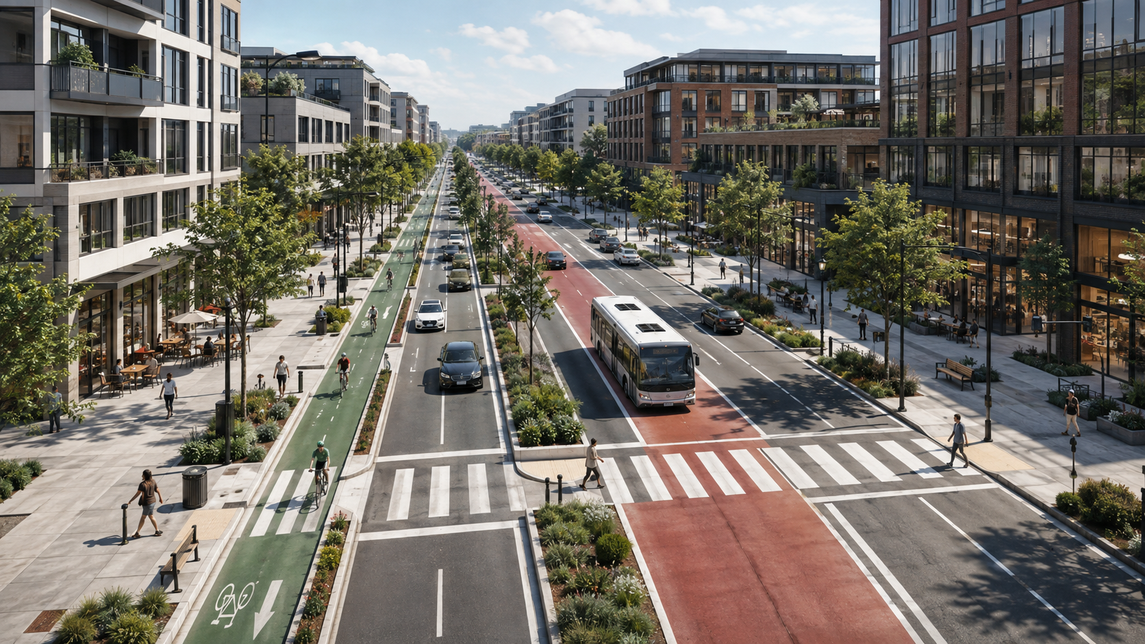
- Vehicle lanes
- Sidewalks
- Protected bike lanes
- Bus lanes and transit stops
- Medians and planting areas
- Parking zones
- Curbs, drainage and underground utilities
A professional road cross section makes it easier to understand how a proposed street will function before the project reaches detailed construction stages.
Why Manual Cross-Section Workflows Create Delays
Many teams still create street sections through a combination of CAD drafting, image editing and repeated manual updates. While this approach can work, it becomes inefficient when project requirements change.
A small adjustment to lane width, curb location or bike infrastructure can require redrawing multiple elements. The challenge grows when stakeholders ask to compare several design options quickly.
Road cross section software reduces this friction by bringing the design process into a single, parameter-driven workflow. Teams can update the relevant inputs, regenerate the section and focus more time on design decisions rather than repetitive production work.
Key Benefits for Engineering and Planning Teams
Faster Design Iteration
Street projects rarely remain unchanged. A road cross section may need to respond to traffic analysis, accessibility requirements, drainage constraints, public feedback or municipal review.
With a structured software workflow, teams can explore alternatives without starting each section from scratch. This is especially valuable when comparing different allocations of the same road width.
Clearer Communication With Stakeholders
A well-prepared cross section helps non-technical stakeholders understand the project. Municipal decision-makers, residents, clients and multidisciplinary teams can see the relationship between sidewalks, travel lanes, landscaping and public transport facilities more easily.
Clear visuals can support more productive discussions and reduce misunderstandings during approvals.
More Consistent Outputs
Consistency matters across a corridor study, master plan or municipal project. Road cross section software helps teams create sections with a unified visual language and geometry, even when several alternatives are being reviewed.
This can improve the quality of reports, presentations and design packages.
Easier Export for Reports and Deliverables
A street section often needs to appear in several formats: a planning presentation, a client report, a public consultation document or an engineering workflow.
KCROSS supports exports such as PNG, PDF and DWF, helping teams move from design development to communication and documentation more efficiently.
What Should You Look for in Road Cross Section Software?
The right tool should support both technical clarity and practical workflow speed. Before choosing a solution, consider the following capabilities.
Parametric Editing
Look for software that lets you adjust section elements through defined parameters. This makes it easier to update widths, materials and street components without rebuilding the entire drawing.
Alternative Comparison
The ability to compare multiple street configurations side by side is useful when evaluating vehicle lanes, transit priorities, active mobility facilities and public-space improvements.
Professional Visual Quality
A cross section should be technically understandable and visually clear enough for presentations. High-quality outputs help bridge the gap between engineering design and stakeholder communication.
Export Flexibility
Confirm that the software can export files suitable for reports, presentations and downstream technical workflows.
Accessibility for Different Roles
Street design is collaborative. A useful platform should support engineers and designers while remaining understandable for planners, urban design teams and municipal stakeholders who may not work in CAD every day.
Typical Use Cases
Road cross section software can support a wide range of planning and infrastructure projects.
Complete Streets Projects
Teams can evaluate how to distribute limited roadway space between vehicles, cyclists, pedestrians, transit, trees and public realm features.
Bike Lane and Active Mobility Planning
Cross sections make it easier to test protected bike lanes, buffers, parking arrangements and pedestrian space before the design advances.
Urban Renewal and Streetscape Design
When a city upgrades a commercial street, residential corridor or town centre, the cross section helps communicate how the public realm will change from building edge to building edge.
Transit Corridor Studies
Bus lanes, stations, boarding areas, pedestrian access and traffic lanes must work together. A clear section helps project teams identify conflicts early.
How KCROSS Supports Faster Street Section Design
KCROSS is built specifically for professional street cross-section creation. It helps transportation engineers, urban planners, landscape architects, architects, municipalities and consulting teams create accurate street sections in a faster, more structured workflow.
Instead of relying on a disconnected AutoCAD-and-Photoshop process, KCROSS uses a parametric platform for generating and refining sections. Teams can adjust parameters, regenerate an updated version and compare design alternatives as the project evolves.
This helps make road cross section software a practical part of everyday planning work—not only a final presentation step.
Final Thoughts
The best road cross section software does more than draw a road. It helps teams make stronger design decisions, explain alternatives clearly and respond to change without losing valuable time.
For projects involving complete streets, active mobility, transit, urban renewal or corridor planning, a dedicated cross-section workflow can improve both speed and communication. KCROSS gives professional teams a focused way to create, update and export street sections with clarity and confidence.