How Smarter Street Design Shapes the Cities of Tomorrow
City future is more than a vision of connected buildings, autonomous vehicles and digital infrastructure. It is a practical question about how cities will use their limited urban space more intelligently.
The future city begins at street level. Every sidewalk, bike lane, transit corridor, parking lane, tree line and vehicle lane is part of a larger urban system. When streets are planned well, cities become safer, more accessible, more efficient and easier to adapt. When streets are planned poorly, even the most advanced technology cannot fix the daily experience of congestion, unsafe movement or unclear public space.
For planners, engineers, landscape architects, municipal agencies and mobility teams, city future is not only about imagining what comes next. It is about turning ideas into clear, measurable and communicable street designs.
What Does City Future Mean in Urban Planning?
City future refers to the way cities are designed, managed and adapted for future needs. It includes smart mobility, climate resilience, better public space, safer streets, stronger public transport and more flexible infrastructure.
But in professional planning, the concept becomes much more practical. A future-ready city must answer questions such as:
- How much space should be allocated to pedestrians?
- Where should bike lanes, bus lanes and vehicle lanes be placed?
- How can cities compare different street design alternatives?
- How can technical teams explain design tradeoffs to decision-makers?
- How can plans be updated quickly when project requirements change?
- How can street designs support smart mobility and public realm goals?
These questions are not abstract. They are visible in every street cross-section.
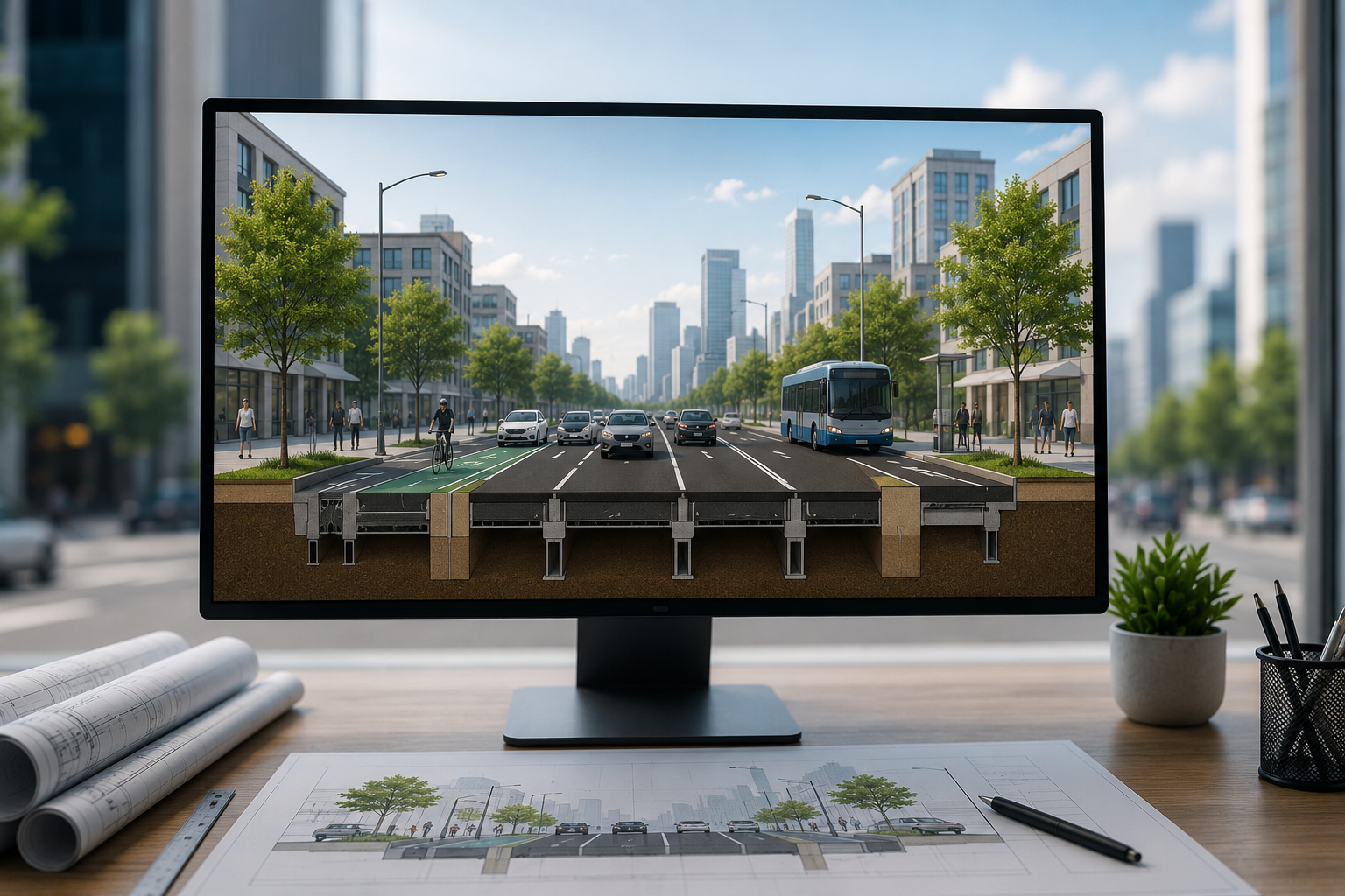
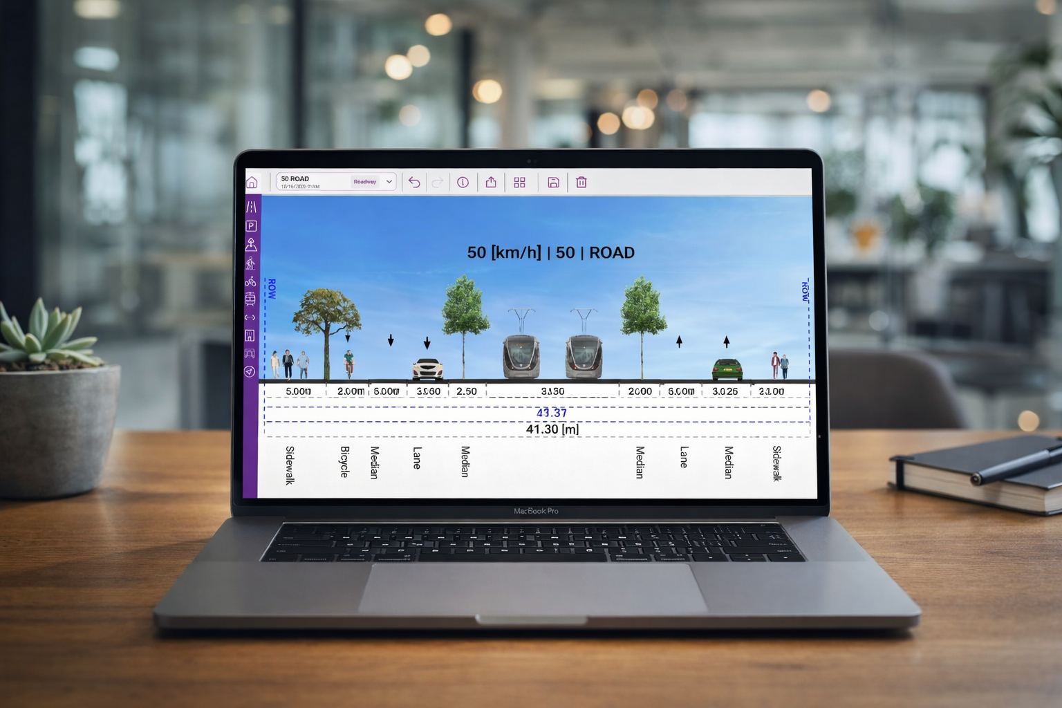
A street cross-section shows how the width of a street is divided between different users and functions. It can show sidewalks, travel lanes, parking, medians, cycle tracks, trees, transit lanes, utilities and public realm elements in one clear view. That makes it one of the most important tools for planning the future city.
Why the Future City Starts With the Street
Most people experience the city through its streets. Streets connect homes, workplaces, schools, shops, parks, transit stops and civic spaces. They are also where the biggest urban conflicts often appear: cars compete with buses, cyclists compete with parking, pedestrians compete with narrow sidewalks, and trees compete with underground utilities.
A city future strategy that ignores the street will remain incomplete.
Future-ready streets need to support several goals at the same time:
| Street Element | Role in the Future City |
|---|---|
| Wider sidewalks | Improve walkability, accessibility and local activity |
| Protected bike lanes | Support active mobility and reduce reliance on private cars |
| Public transport priority | Improve network reliability and move more people efficiently |
| Trees and green infrastructure | Improve comfort, shade and environmental performance |
| Parking and loading areas | Support local access without dominating the street |
| Vehicle lanes | Preserve necessary movement while balancing other users |
| Medians and buffers | Improve safety, separation and street organization |
| Street cross-sections | Help teams visualize and compare design alternatives |
This is why street design is central to every serious city future discussion. The physical allocation of street space is where policy becomes reality.
City Future and Smart Mobility
Smart mobility is often associated with sensors, data platforms, electric vehicles, connected fleets and mobility apps. These tools are important, but they are only part of the story.
Smart mobility also depends on the physical design of the street.
A city can have advanced mobility technology, but if the corridor does not include safe walking routes, clear bike infrastructure, reliable transit priority and well-organized public space, the mobility system will still be limited.
The strongest city future strategies combine digital tools with physical planning. They ask how people move, where street space is limited, which modes should be prioritized and how design alternatives can be tested before decisions are made.
For example, a mobility team may need to compare:
- A street with two vehicle lanes and curbside parking.
- A street with a dedicated bus lane and wider sidewalks.
- A street with protected bike lanes and reduced parking.
- A complete street layout with trees, buffers, transit space and active mobility infrastructure.
Each option has tradeoffs. A professional street cross-section makes those tradeoffs visible.
Why Street Cross-Sections Matter for City Future Planning
A street cross-section helps planners and engineers communicate the structure of a street in a clear and practical way. Instead of relying only on long reports or technical drawings, teams can show how each design option changes the street.
This is especially important in city future projects because future-ready streets are often multi-functional. They need to support movement, access, safety, comfort, climate adaptation, public space and future flexibility.
A strong street cross-section can help answer key planning questions:
- Is there enough space for pedestrians?
- Are bike facilities protected and continuous?
- Does public transport receive the right level of priority?
- Are trees, buffers and public realm elements integrated into the design?
- Is the street width being used efficiently?
- Can decision-makers understand the difference between alternatives?
- Can the design be updated quickly when the project changes?
When these questions are answered visually, the planning process becomes clearer and more collaborative.
The Problem With Traditional Street Design Workflows
Many planning and engineering teams still create street cross-sections through a manual workflow. A typical process may involve CAD drafting, graphic editing, repeated revisions and separate presentation preparation.
This can work, but it often becomes slow when alternatives need to be tested.
A small change, such as adjusting a sidewalk width, adding a bike lane or modifying a median, can require several manual updates. When a project includes multiple design options, the process becomes even more time-consuming.
Traditional workflows can create several challenges:
- Repeated redrawing after every design change.
- Slow updates when parameters change.
- Difficulty comparing alternatives side by side.
- Dependence on CAD or visualization specialists.
- Extra work to prepare presentation-ready outputs.
- Communication gaps between technical teams and stakeholders.
City future planning needs faster iteration. Cities change quickly, and planning teams need tools that help them move from concept to clear output without restarting the process every time a parameter changes.
How Parametric Street Design Supports the Future City
Parametric design helps planning teams create and update street cross-sections by changing defined inputs instead of redrawing everything manually.
In a street design workflow, those inputs may include sidewalk width, lane width, bike lane width, median width, parking configuration, green infrastructure zones or public transport space.
This matters because future-ready streets require comparison. A single corridor may need several possible layouts before the right direction is selected. A parametric workflow makes it easier to adjust the design, regenerate the section and present alternatives clearly.
| Planning Need | Manual Workflow | Parametric Workflow |
|---|---|---|
| Change a lane width | Redraw and reformat the section | Adjust the parameter and update the output |
| Add a bike lane | Rework geometry and visuals | Add or modify the relevant street element |
| Compare alternatives | Create separate drawings manually | Generate and compare design options faster |
| Prepare a presentation | Export and polish visuals separately | Use presentation-ready outputs |
| Update after feedback | Repeat several production steps | Revise the section more directly |
For city future projects, this kind of workflow supports better decision-making because teams can test more options in less time.
Where KCROSS Fits Into City Future Planning
KCROSS is street cross-section software built for professionals who need to create, update, compare and export street and corridor sections. It is positioned for transportation engineers, urban planners, landscape architects, architects, municipal agencies, DOTs and consulting firms.
In the context of city future, KCROSS helps turn street design ideas into clear cross-section outputs. It supports a parameter-based workflow, allowing teams to work more efficiently than traditional manual drafting and graphic editing processes.
KCROSS is especially relevant when teams need to:
- Create accurate street cross-sections.
- Compare design alternatives side by side.
- Communicate street-space tradeoffs clearly.
- Produce export-ready outputs for reports and presentations.
- Support smart mobility and corridor planning discussions.
- Reduce time spent on repetitive section updates.
According to the KCROSS product positioning, the tool replaces the traditional AutoCAD plus Photoshop workflow for street cross-section creation with one parametric platform. It also supports exports to PNG, PDF and DWF, making it useful for both visual communication and CAD-connected deliverables.
City Future Requires Better Communication
Urban planning is not only a technical process. It is also a communication process.
A city future project may involve engineers, planners, architects, landscape architects, elected officials, municipal staff, consultants, residents and private stakeholders. Each group may understand the street differently.
Technical drawings are important, but they are not always easy for every stakeholder to read. A clear street cross-section helps bridge that gap. It turns complex street-space decisions into a format that more people can understand.
For example, instead of explaining that one alternative reallocates curbside parking to active mobility, a planner can show the exact change in the street section. Instead of saying that a transit-priority option requires a different lane configuration, the team can present the layout visually.
This makes conversations more specific. Instead of debating general ideas, teams can discuss widths, elements, tradeoffs and priorities.
Key Elements of a Future-Ready Street
A future-ready street is not defined by one technology or one mode of transport. It is defined by balance, adaptability and clarity.
The most effective city future street designs usually include the following principles:
1. People-first movement
A future city should make walking, cycling and public transport practical and safe. This does not mean every street removes cars. It means the street is designed around people, not only vehicle flow.
2. Flexible street-space allocation
The needs of a corridor can change over time. A street that functions mainly as a vehicle route today may become a transit corridor, a cycling corridor or a more public-facing commercial street in the future. Flexible planning helps cities adapt without losing clarity.
3. Clear mobility hierarchy
Not every street should prioritize every mode equally. Some streets should prioritize transit. Others should prioritize walking, cycling, logistics or local access. A street cross-section helps define that hierarchy.
4. Better public realm
Street design is also public space design. Shade, trees, seating, lighting, buffers and sidewalks affect how people experience the city every day.
5. Fast design iteration
Future city planning requires multiple scenarios. Teams need to test, compare, revise and explain options quickly. Tools that support faster iteration can improve both design quality and project communication.
City Future and Complete Streets
The idea of city future is closely connected to complete streets. A complete street is planned for multiple users, not only private vehicles. It considers pedestrians, cyclists, public transport users, drivers, emergency access, deliveries and public space needs.
A complete street cross-section may include:
- Accessible sidewalks.
- Protected cycle tracks.
- Bus lanes or transit priority.
- Safe crossings and medians.
- Trees and green infrastructure.
- Parking or loading where needed.
- Buffers between movement types.
- Clear space allocation for every user.
This makes complete streets a practical model for future city planning. They help cities move away from single-purpose road design and toward streets that support mobility, safety and urban life at the same time.
How to Plan a Street for the Future City
A practical city future workflow can begin with a simple structure:
- Define the role of the street.
Identify whether the corridor should prioritize walking, cycling, public transport, vehicle movement, local access, commercial activity or a combination of these functions. - Map the existing street width.
Start with the right-of-way, curb-to-curb width, sidewalks, lanes, parking, medians, trees and current constraints. - Identify mobility and public realm goals.
Clarify whether the project needs safer walking, better cycling, transit priority, traffic calming, more shade, improved accessibility or clearer public space. - Create a base street cross-section.
Show the existing condition in a clear format so the team can understand the starting point. - Build design alternatives.
Create multiple options that test different space allocations. - Compare the alternatives.
Evaluate each option by safety, accessibility, mobility performance, public realm quality, cost, feasibility and stakeholder needs. - Update the preferred option.
Use feedback to refine the section and prepare it for reports, meetings or further design development. - Export and communicate.
Share the final or interim section in formats that match the project workflow, such as presentations, reports or CAD environments.
This process turns city future from a broad concept into a repeatable planning method.
Why City Future Depends on Better Planning Tools
The cities of tomorrow will not be shaped only by large infrastructure projects. They will also be shaped by thousands of smaller design decisions: where a sidewalk expands, where a bus lane begins, where a bike lane is protected, where parking is reduced, where trees are added and where street space is rebalanced.
Better planning tools help teams make those decisions with more confidence.
For professionals working on city future projects, the right tool should support:
- Fast street cross-section creation.
- Clear parameter-based editing.
- Side-by-side alternative comparison.
- Presentation-quality visuals.
- Export-ready outputs.
- Collaboration between technical and non-technical stakeholders.
- Practical communication for planning meetings and public-sector review.
KCROSS fits this need by focusing on street and corridor cross-sections rather than trying to be a general-purpose design platform. Its value is in helping professional teams move faster from design concept to communicable output.
City Future Is Not Only About Technology
Technology will play a major role in future cities. But the future city is not defined by technology alone.
A truly successful city future strategy must improve how people move, how streets function and how public space supports daily life. That requires practical planning, clear communication and better ways to compare alternatives.
A smart city is not only a connected city. It is a city where the physical street network supports better decisions.
That is why street cross-sections matter. They show how future mobility, public space and infrastructure priorities fit into the same limited urban width.
Conclusion: City Future Starts With Clearer Street Design
City future begins where people experience the city most directly: the street.
Every future-ready city needs better ways to plan, test and communicate street design alternatives. Whether the goal is smart mobility, complete streets, safer pedestrian movement, improved cycling infrastructure, transit priority or better public realm design, the street cross-section is one of the clearest ways to make those decisions visible.
KCROSS supports this process by helping professionals create, update, compare and export street cross-sections through a parameter-based workflow. For engineers, planners, landscape architects, municipal agencies, DOTs and consulting firms, it provides a practical way to move from concept to clearer street design outputs.
The future city is not built in theory. It is built one street, one corridor and one cross-section at a time.
CTA
Planning a street, corridor or smart mobility project? Use KCROSS to create professional street cross-sections, compare design alternatives and communicate street-space decisions more clearly.
Get KCROSS and create your next section faster.
FAQ: City Future and Street Cross-Section Planning
What does city future mean?
City future refers to the planning, design and management of cities for future needs. It includes smart mobility, public transport, walkability, cycling, climate resilience, public space and more adaptable infrastructure.
Why are street cross-sections important for city future planning?
Street cross-sections show how street space is divided between sidewalks, vehicle lanes, bike lanes, transit lanes, parking, medians, trees and other elements. They help planners and decision-makers understand design tradeoffs clearly.
How does smart mobility connect to street design?
Smart mobility depends on both technology and physical infrastructure. A city may use advanced mobility systems, but the street still needs safe walking routes, cycling facilities, public transport priority and clear space allocation.
What is KCROSS?
KCROSS is street cross-section software for creating, updating, comparing and exporting professional street sections. It is designed for transportation engineers, urban planners, landscape architects, architects, municipal agencies, DOTs and consulting firms.
Does KCROSS require CAD experience?
KCROSS is positioned as a parameter-based platform, so it can support users who need professional street cross-sections without relying only on traditional CAD workflows.
What file formats can KCROSS export?
KCROSS supports exports to PNG, PDF and DWF. These formats help teams use street cross-sections in presentations, reports and CAD-related workflows.
How can KCROSS support future city projects?
KCROSS helps teams create street cross-sections faster, update designs when parameters change, compare alternatives side by side and communicate street-space decisions clearly to stakeholders.
Is city future only about smart technology?
No. Technology is part of the future city, but city future also depends on street design, mobility planning, public space, accessibility, safety and the ability to adapt urban infrastructure over time.